The Biodiversity Blueprint is our working set of maps to allow all community members to see themselves in the landscape, understand that landscape and come up with ideas on how that landscape can be improved from an environmental perspective.
To leave a comment
or ask a question 
To see our
biodiversity gallery 
|
The Biodiversity Blueprint has achieved many great outcomes. It involved over 30 landholders and saw 75 proposed projects identified.
Why was it developed? The Biodiversity Blueprint was the first major milestone for the JARR project. As such, its roots and development lay within the Albert River, Wonyip, Madalya and Binginwarri Landcare Groups. In an effort to better coordinate and integrate rapidly declining funding for landholder works the Blueprint was recognised as being a crucial starting point in strategically placing biodiversity-based works within this catchment. 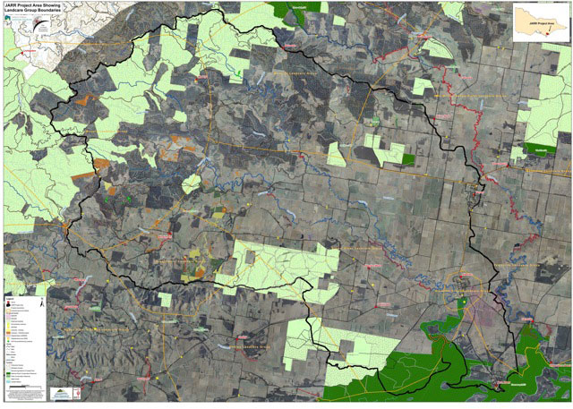
The master map, showing the total of the JARR project area.
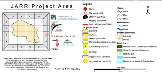
The master map was broken into smaller areas to allow for identification of individual projects.
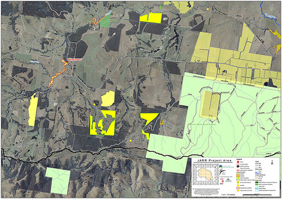
Each Landcare group received a detailed map of the quadrant/s relevant to them. This one is of section B-3 in Binginwarri.
|
JARR Partners
Albert River Landcare Binginwarri Landcare Wonyip Landcare Yarram Urban Landcare Yarram Secondary College Waterwatch Trust for Nature Greening Australia 


|
|
The aim of the Blueprint was to:
The Blueprint is essentially a planning instrument that enables us to better coordinate on-ground works across the JARR area and make better use of investment streams. Physically the Blueprint exists as a series of detailed A1-sized maps that we can use for various levels of planning (from individual property to entire landscape) and, critically, investment planning. It allows us to look at the detail on the ground and make informed decsions about where an investment line is best placed for its particular purpose. From a landholder's point of view, the Blueprint is an important tool to help understand not only what has occurred in the landscape in the past, but what everyone is thinking of doing into the future. It gives the ability to plan with neighbours to develop a wide range of integrated outcomes. Examples range from cross-property shelterbelts that form the dual purpose of shelter for stock and habitat for animals, through to enhancing weed control on a property by working with an upstream neighbour to rid a multi-property gully system of blackberry. How was it developed? The Biodiversity Blueprint was developed by YYLN staff in consultation with the wider Landcare community and layered, laminated working maps were produced to allow for marking projects directly onto the maps. Maps were then updated and master copies made. Each Landcare group received copies of the maps relevant to their particular area. The Norman Wettenhall Foundation graciously funded the project as part of their focus on Landscape Restoration in south eastern Australia. Their investment to the project was bolstered by a financial contribution by the Yarram Yarram Landcare Network. This investment was used to: 1. Contract a project officer to map onground works; 2. Contract a GIS worker to collate all historical and current information and develop the map layers; 3. Hold community workshops to locate past projects and map out future projects; and 4. Printing and development of the physical Blueprint. Future investment will pay for: 1. Continuation of project officer work; 2. Continuation of GIS worker where required; 3. Development of an interactive website including the ability for Landholders to edit maps online; and 4. On-ground works incentive program. |
